Hunting
Plan field days, organize your hunting journal and coordinate your team from one place.
- 3D and satellite maps
- Hunting areas and markers
- Team and radio tools
Maps, routes, forecasts, journals and safety tools for hunting, fishing, camping and hiking. Plan before you leave, stay informed in the field and return with every adventure recorded.
 WILDIGO · FIELD MODE
Choose today's activity and head outdoors.
A new hunting-area experience
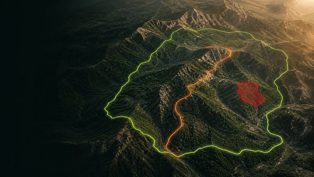
3D is no longer a separate screen but a map type: the fourth option next to standard, satellite and hybrid. Once a hunt starts your route, the hunting boundary and restricted zones are drawn on whichever you pick — you never lose sight of the hunt to look behind a ridge.
One platform · four experiences
Wildigo adapts to your activity and brings forward the tools you need without unnecessary clutter.
Plan field days, organize your hunting journal and coordinate your team from one place.
Use solunar forecasts and weather intelligence to assess the right place and time.
Organize camp spots, complete your packing list and carry a practical safety plan.
Record routes, follow elevation changes and archive adventures with GPX support.
Field toolkit
Filter the feature set and discover how Wildigo supports every stage of an outdoor adventure.
Switch between standard, satellite, hybrid and true-elevation 3D with one tap. Hunting boundaries, prohibited zones and your live route are drawn on all four.
From the moment a hunt starts, your position is tracked against the hunting boundary. You are warned as you approach a boundary or a restricted zone, and recording continues with the screen off.
Download the ground before you leave. With no signal the map still draws at the resolution you downloaded. A satellite package costs half the tiles of hybrid.
Record distance, duration and elevation. Name, save, import and export your outdoor routes.
Hourly weather, wind, pressure and fishing activity insights that support better field decisions.
Organize hunting, fishing, camping and hiking records with photos, locations and notes.
Make field safety visible with live location, safety zones and trusted emergency contacts.
Stay connected with fast voice communication and monitor your group during field activities.
Use a team code or scan a QR code to join quickly and access the shared field plan.
Save important locations, mark favorites and filter recently visited places.
Consistent Turkish and English interfaces with region-aware measurements, dates and emergency options.
Map layers, team positions and route statistics come together in one field view.
Guardian safety layer
Guardian brings team coordination and emergency readiness together. Emergency actions adapt to the country and region you are in.
Share your location with people you trust and monitor movement outside a defined area.
Connect using a QR code or team code and communicate quickly in the field.
Use emergency guidance appropriate to your device and location instead of a fixed country number.
Frequently asked
No. Wildigo 2.0 combines hunting, fishing, camping and hiking with shared mapping, journaling and safety tools.
Premium offline maps let you prepare selected regions for use where mobile connectivity is limited.
Use Profile > Settings inside the app or submit a request through our Delete Account and Data page.
Yes. Wildigo provides Turkish and English interfaces with localized measurements and regional safety options.
Download Wildigo and manage your plans, team and outdoor journal from one place.